California Satellite Methane Project
About
Methane is a powerful greenhouse gas and the second largest contributor to climate change after carbon dioxide (CO2). It traps heat much more effectively than CO₂— about 80 times more over 20 years. Methane remains in the atmosphere for about 12 years, making it a short-lived climate pollutant. Reducing methane emissions can be an effective and rapid method to slow climate change.
California Satellite Methane Project (CalSMP)
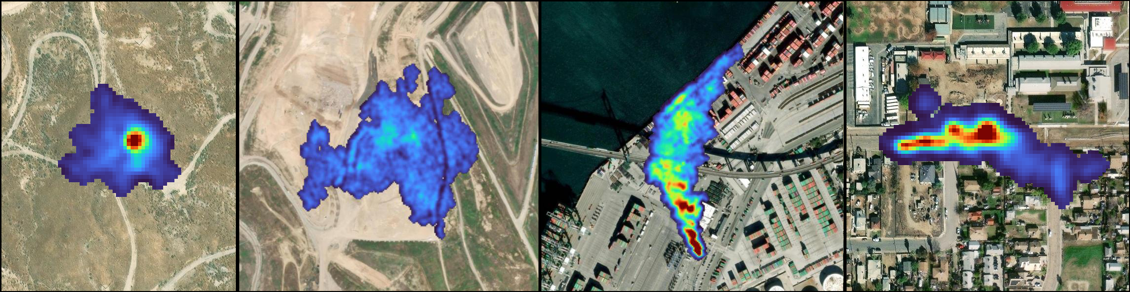
Over the past decade, CARB and its research partners have shown that a new class of remote sensing technology, known as methane plume imagers, can detect emissions from large, discrete sources of methane such as an oil well or gas collection infrastructure on a landfill. This technology helps detect methane emissions and often supports actions to reduce or stop methane leaks.
CARB's research program funded multiple airborne studies, which were among the world's first successful large-scale demonstrations of methane plume imager technologies. Armed with lessons learned from these research studies, California is now among the first in the world to embrace satellite-based methane plume imagers. This innovation allows for faster identification, more frequent observations, and more complete coverage of methane sources around the State. This supports California's climate goals by helping discover and ultimately repair methane leaks more quickly.
CARB's CalSMP is a new project applying what was learned in previous studies to new data acquired from satellites. Information from the satellites will provide CARB with data so we can work with regional and local agencies together with industry to mitigate the public health and environmental threat. The project provides data that has been integrated into the oil and gas methane regulation and is being considered under landfill methane regulation amendments. This will allow the data to be used for mitigation and enforcement if needed.
CARB will use these satellite data to enable quick detection and visualization of high-emitting methane sources. CARB has selected Carbon Mapper as the data provider and has begun receiving data. More information about this process can be found here. Plume observations received through this project will be published 30 days after the time of observation. These plumes are publicly available on our data provider Carbon Mapper’s global web portal. CARB has published a CalSMP Dashboard to display these plumes along with additional information about the actions taken to address the emissions. Building on its successful regulatory programs to reduce greenhouse gas emissions, CARB is committed to using the satellite data to further mitigate emissions while showcasing the value of using this novel data type to other jurisdictions.