Harbor Communities Monitoring Study - Mobile Monitoring Platform
Categories
Contact
This page updated March 09, 2015

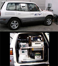
Pilot Study Vehicle
The Mobile Monitoring Platform is another tool ARB will use to help provide spatially and temporally resolved data to determine how various local sources impact community air. This tool allows us to measure air pollution over a wide area.
What is the Mobile Monitoring Platform?
The mobile platform is an electric vehicle equipped with a number of instruments to monitor air pollution. The platform will be driven around the Harbor Communities area to measure pollutants and make direct comparisons of different locations at nearly the same times.
What and when are we measuring?
All pollutants previously listed will be measured with the Mobile Platform.
Mobile measurements will occur at the same times as the Passive Sampling measurements.
How were the routes selected? What are the exact routes?
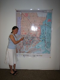
Four maps illustrate proposed routes to be driven during the mobile monitoring study, and were mapped by CARB staff with input from community groups. Several factors were considered by CARB staff when mapping these routes:
- Low income neighborhoods were weighted more heavily than higher income areas.
- Areas often downwind of sources were emphasized, particularly if residential.
- Locations predicted by computer modeling to have high concentrations were also emphasized.
- Route length was limited by the range of the electric vehicle, about 75 miles.
- Only public roads with public access were considered.
In addition, the community also provided the following input (from the 4/25/06 community meeting held at the Wilmington Senior Center):

- Greater emphasis on locations of schools and parks or recreation centers
- Additions of specific refineries, related activities and other industrial facilities (such as sulfur plants)
- Greater emphasis on rail yards and switching yards.
- Include all streets with high truck traffic
- Include the Joint Water Pollution Control Plant (JWPCP 24501 S. Figueroa Carson 90745) on the routes
- Include Occupational Centers (Harbor Occupational Center by the China Shipping Berth on Front St. and an Occupational Center on Island and Harry Bridges).on the routes.
- Include Southwest Long Beach (downtown area)
These inputs resulted in modified routes. The changes made are indicated on the maps. However, we were not able to accommodate all community inputs.
Note: We initially believed we could measure methyl bromide, a chemical used to treat produce. At the time of the meeting we believed we could measure this chemical, but we were mistaken, so we will not be measuring this chemical.
Click here to go back to the Main Page of Harbor Communities Monitoring Study.
To receive updates on this web page and the Harbor Communities Monitoring project, please subscribe to the HCM listserve.
