California Prescribed Fire Emissions Estimates
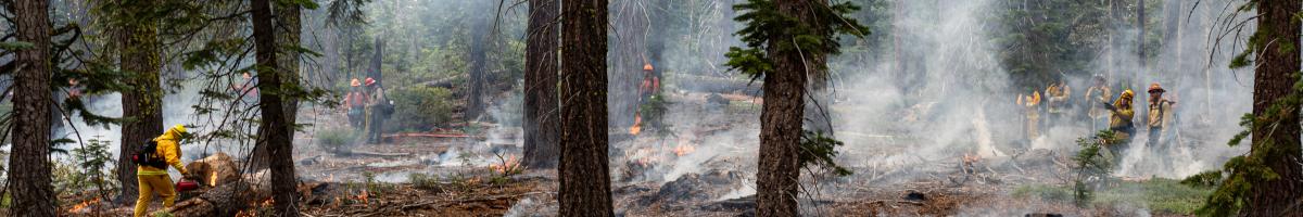
Prescribed fire is planned, intentional ignition applied by land managers to reduce vegetation fuels that feed potential future wildfire, reduce wildfire risk on communities and infrastructures, restore ecosystem health, and support landscapes that depend on periodic burning. It is a planned, carefully managed tool used across California and other parts of the United States and the world. Unlike large wildfires, prescribed burns are conducted under specific weather and fuel conditions to keep fire behavior low intensity and predictable. California has set ambitious goals to expand the use of prescribed fire to reduce hazardous fuel buildup, improve forest resilience, and help protect communities from severe wildfire.
This webpage provides estimates of air pollutant emissions produced by the vegetation and other natural fuels intentionally consumed during prescribed fire operations. These data represent the amount of pollutants released at the point of combustion on the day and at the location where burning occurred.
Where smoke travels after ignition depends on many factors, including weather, terrain, and the operational conditions of the burn. As a result, smoke movement can vary considerably from one prescribed fire to another, even when they have similar objectives or fuel types. The emissions presented here describe only the quantity of pollutants released—they do not reflect how smoke disperses or what levels of smoke may be experienced by nearby communities. For more information about how prescribed fire smoke may affect local air quality and tips for reducing smoke exposure, please see the additional links at the bottom of this webpage.
Summary of Prescribed Fire Activity and Emissions
The graphs below summarize statewide prescribed fire activity and associated PM2.5 emissions across California. In Figure 1, daily emissions patterns show that most PM2.5 from prescribed burning occurs during concentrated seasonal burn windows, particularly in the fall, with both flaming and smoldering combustion contributing to emissions. Emissions are generally low and sporadic through most of the year. The largest emission peaks occur in October and early November, where both flaming and smoldering emissions increase sharply, with smoldering generally higher during the largest events. This pattern indicates that most daily PM2.5 emissions from prescribed burning occur during a concentrated fall burn period. Figure 1 does not include additional prescribed burns for which the burner did not record a burn date and there was no satellite fire detect to fill in the burn date.

Figure 2 presents the geographic distribution of prescribed burn PM2.5 emissions and burn acreage across California air basins. Majority of prescribed burns in California are in the northern part of the state. In other parts of the state, prescribed burn is conducted mostly in mountainous regions and areas covered with natural vegetations.

Prescribed Fire Emissions Data
California Air Resources Board (CARB) staff revamped the methodology and the data sources of the Prescribed Fire Emission Inventory in the 2025-2026 inventory cycle. Published in 2026, the 2023 emission inventory differs from previous inventory vintages in the following ways: it integrates activity datasets collected and compiled by local/state/federal air and land management agencies, the most extensive data reconciliation effort among similar datasets to date; uses satellite fire detect data to fill in burn date that was not recorded by the burner; refines fuel consumption assumptions specific to fuel compartments; and employs emission estimation pathways that are specific to combustion phase (e.g., flaming vs. smoldering) and burn type (broadcast burn, pile burn, or air curtain incinerator or carbonizer). It is spatially and temporally explicit inventory with day-by-day emissions and location information. The following inventory data are available:
- A detailed table of 2023 prescribed fire emissions, categorized by burn type (broadcast, pile burn, and air curtain incinerator or carbonizer) and further separated into flaming and smoldering emissions.
- Technical documentation of inventory methods
- Appendix 1: Documentation of Fuel Characteristic Classification System Fuelbeds lookups for Air District and Interagency Treatment and Tracking System prescribed fire records.
Archive of previous inventory vintages:
- Documentation of the methodology prior to the 2023 inventory:
- Look up historical inventory data using the CEPAM query tool
- Instructions: Go to the CEPAM Query Tool, select the inventory year and the geographic area that you want to look up, choose Source Type “Area,” and click “Run Report.” Navigate to Rx Fire Emissions by subsequently clicking the following: “MISCELLANEOUS PROCESSES,” “MANAGED BURNING AND DISPOSAL,” and scroll down to “664-RANGE IMPROVEMENT” AND “666-FOREST MANAGEMENT.”
For a summary of the inventory methodology, see the Oct 16, 2025, public webinar presentation in the Webinar Presentation section below.
Webinar Presentation
WebinarOct 2025 | Public Webinar (October 16, 2025): California Wildfire and Prescribed Fire Emission InventoryThe California Air Resources Board (CARB) hosted a public webinar on updates to the statewide wildfire and prescribed fire emission inventory. CARB staff presented refinements to emission quantification methodology, expansion of activity data sources, and a new methodological framework for generating an event-based inventory by utilizing satellite fire detection data. In an event-based inventory, emissions are estimated for each day of fire and by their geospatially explicit location. These inventory enhancements will provide more detailed and accurate fire emissions information to support various air quality management applications and facilitate a better understanding of the impact of fire emissions on air quality. The inventory data also support tracking progress towards California’s statewide goals for climate change and land management. |
Additional Information & Resources
Prescribed Fire Data Reporting & Smoke Management
Prescribed Burning (General Information Webpage)
Smoke Management Program for Prescribed & Agricultural Burning
Prescribed Fire Information Reporting System (PFIRS)
Fire & Exceptional-Event Assessment, Screening, & Toolkit (FEAST)
California Smoke Spotter Application
California Wildfire & Forest Resilience Task Force, Interagency Treatment Tracking System (ITS)
Emission Inventory
Criteria Pollutant Emission Inventory (all emission source categories)
Other Related Programs
Natural & Working Lands Inventory